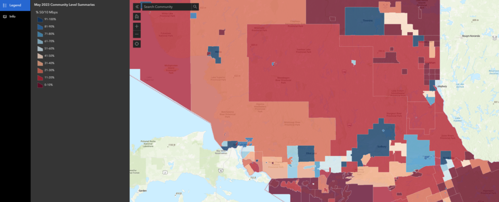
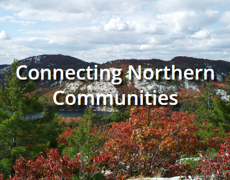
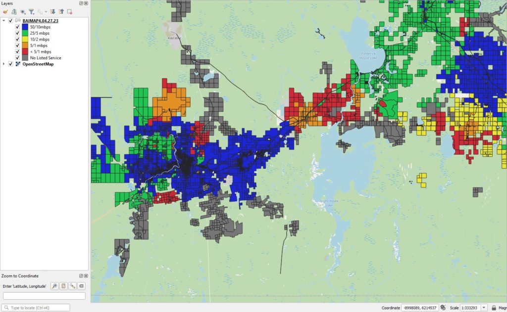
Broadband Expansion Approach
OVERVIEW Our objective is to provide every household in our service delivery region with an economical connection of at least 50 Mbps download and 10 Mbps upload as per the CRTC targets. Low density population is the main reason providers are unwilling to invest in infrastructure improvements. Parity between urban and rural internet access is likely not realistic. Private sector must be […]
Read More
BAIMAP
BROADBAND & ASSOCIATED INFRASTRUCTURE MAPPING ANALYSIS PROJECT (BAIMAP) What is BAIMAP? BAIMAP is a GIS application developed by Blue Sky Net which has access to broadband infrastructure data for Northern Ontario down to the property parcel level. BAIMAP’s History. It is has been a universal understanding for some time that access to high speed internet is essential for advancing our […]
Read More
Municipal GIS Partnership
Municipal GIS Partnership Municipalities in Northern Ontario are faced with the double challenge of satisfying a need for data and information from a wide variety of requesters (internal staff, councillors, investors, business people, officials from other levels of government, the media, social service organizations, the general public) and doing so from a widely disparate collection of data sets (tax rolls, zoning records, […]
Read More
Connectednorth
We all need to be connected. However, access to the services that allow us to connect can be tough to find when you live in Northern Ontario. The open spaces and the rugged beauty that draw us and keep us here can also create obstacles. Since 2012 Blue Sky Net, a non-profit technology development corporation funded by FedNor, has collected coverage and […]
Read More